


The Best Cinque Terre Hikes: Explore Italy’s Coastal Wonderland on Foot
Discover the best Cinque Terre hikes with this handy guide. All the best trails in Cinque Terre – from challenging treks to gentle strolls through the Italian countryside.
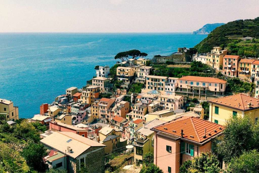
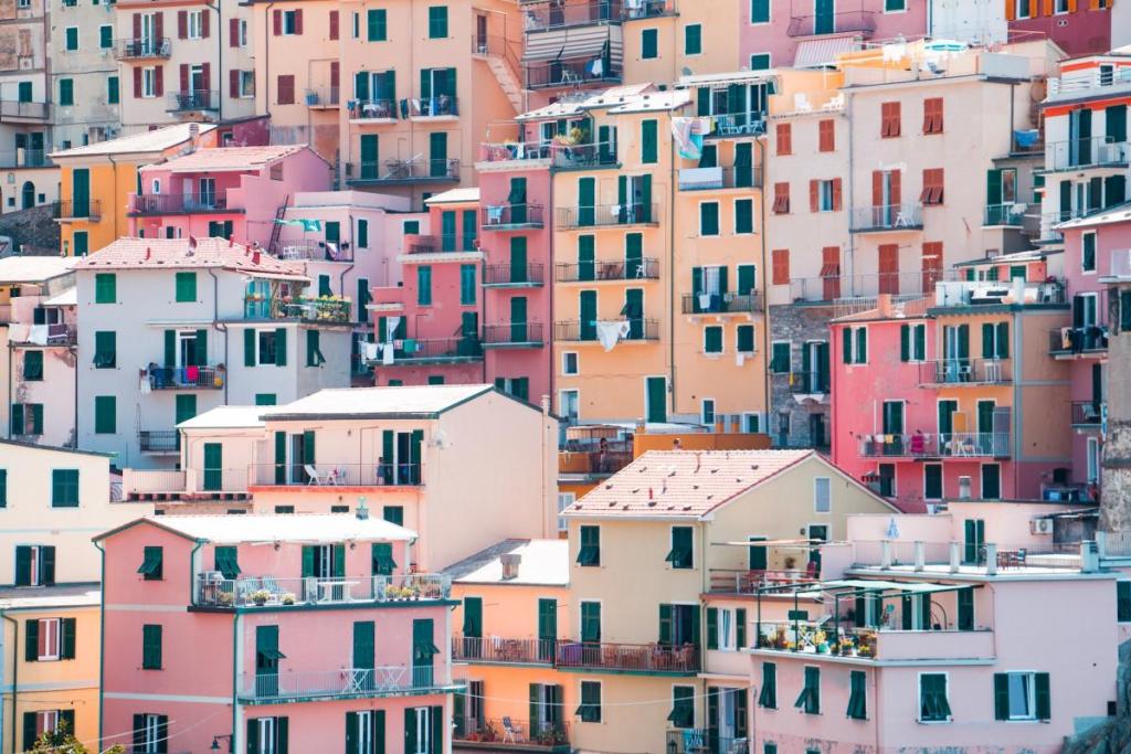
Have you visited Cinque Terre? This stunning Italian region is known for its colourful seaside villages, rugged cliffs, and terraced vineyards. And, while many visitors come to Cinque Terre to soak up the sun and the sea (not to mention these gorgeous beaches), the area is also a hiker’s paradise.
We’re not kidding. Cinque Terre boasts a network of trails that offer spectacular views and unforgettable experiences. From short and easy walks to long and difficult hikes, there is a trail for every type of hiker to showcase the natural beauty of the region.
We can’t quite think of a better way to admire this picturesque corner of Italy than on foot – which is why it’s so great that Cinque Terre boasts plenty of picturesque hiking trails.
These are our favourites…
Best Cinque Terre Trails
The Blue Path
Distance: 12 km • Difficulty: Moderate • Map
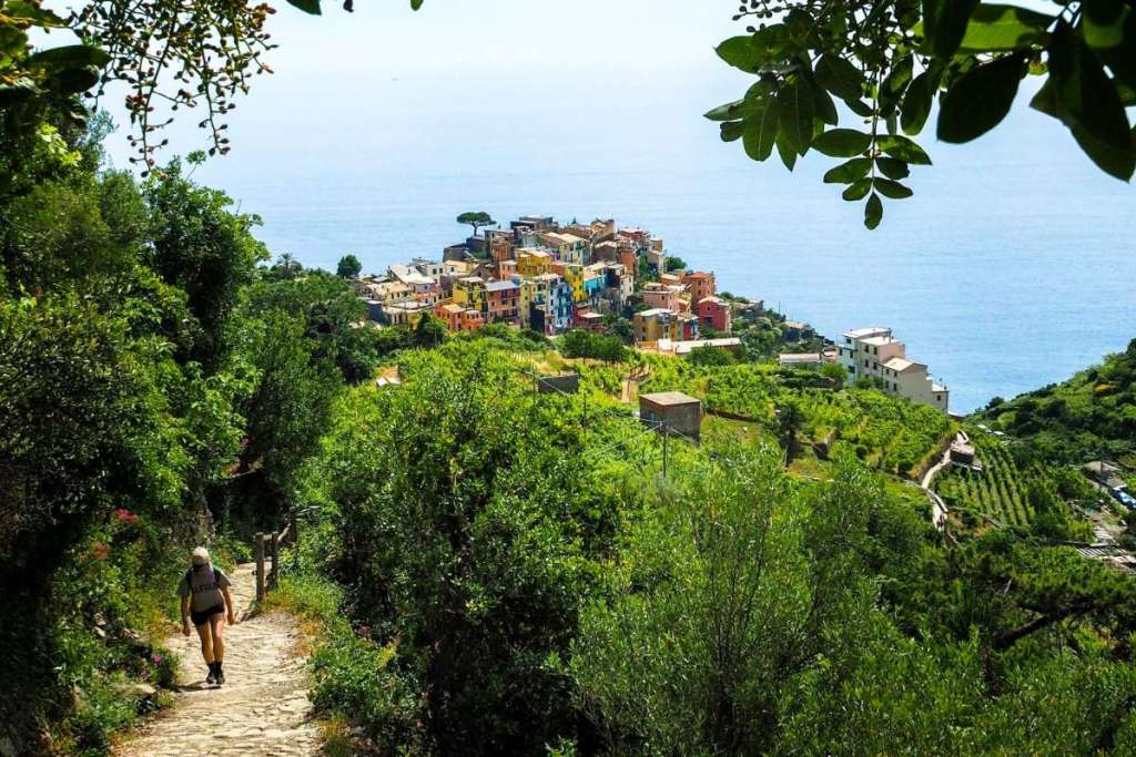
The most iconic of all hiking trails in the Cinque Terre towns, The Blue Path connects all five towns. Which is perfect if you’re looking to explore the entire Cinque Terre region in one (seriously jam-packed) day.
Fun fact: this route is named after the bright blue ocean that you’ll be able to gaze at throughout the entirety of the trail. You can choose to start either at Riomaggiore or Monterosso and work your way through the five towns. You’ll be glad to hear that it’s not too difficult to hike the entire thing, if you’ve got the stamina.
You’ll need to purchase the Cinque Terre Card to be able to hike this path (it costs between €5-7 depending on the season). You can purchase this pass at the town’s train stations, tourist offices, or here if you’re pretty confident in your Italian.
Vernazza to Monterosso
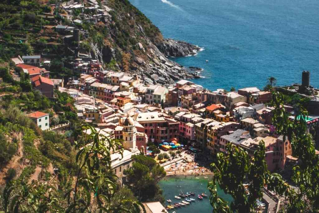
Distance: 3.6 km • Difficulty: Moderate • Map
While most people actually start this route in Monterosso and make their way to Vernazza, we think that this route is slightly easier if you do the reverse. You’ll be glad you listened to our advice in the blaring Italian heat.
As you’re hiking pretty high up on the very edge of the coast, expect views for dayzzz. Jokes aside, make sure that your phone is fully charged (not just because the medic posts urge you to save the emergency services number along the route) so that you can snap plenty of pictures.
We also recommend making a near-the-finish-line pit stop at Ristorante La Terrazza, one of the best eateries in Cinque Terre, for some fuel once you reach Monterosso.
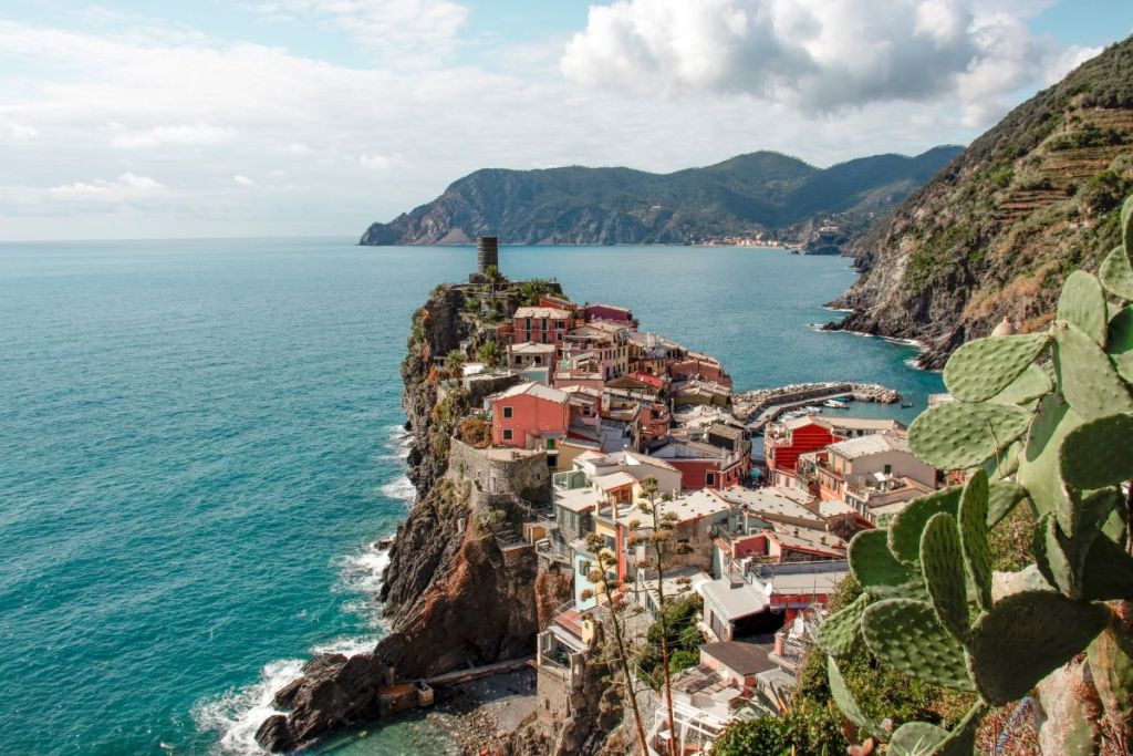
The Path of Love (The Via dell’Amore)
Distance: 1.3km • Difficulty: Easy • Map
If you only have time to hike one section of The Blue Path, make it The Path of Love.
Connecting the towns of Riomaggiore and Manarola, this is one of the shortest hiking routes in Cinque Terre, though it’s one of the most picturesque.
Note: This path is currently closed for renovations after a landslide left the path completely unsafe, but it will be reopening to the public at some point in 2024.
Don’t fancy hiking between the Cinque Terre towns? Book a Cinque Terre boat cruise instead and float between each stunning seaside village.
The High Path of the Cinque Terre (Alta Via delle Cinque Terre)
Distance: 35.9km • Difficulty: Hard • Map
Ready for a seriously challenging Cinque Terre hike? The High Path of Cinque Terre connects Portovenere to Levanto via the ridges that run above the villages.
It’s a long hike, and would take around two days if you hiked this pretty much straight – we recommend taking a few days to explore the route and make pit stops along the way. The trail is well-marked but strenuous, with steep inclines and declines, rocky terrain, and narrow paths that require a good level of physical fitness and experience in hiking.
This hike is worth the intense grind, though. Along the way, you’ll be able to admire the serene landscapes of olive groves, vineyards, and woodland areas. Make sure you bring your camera – the photo opportunities are pretty amazing.
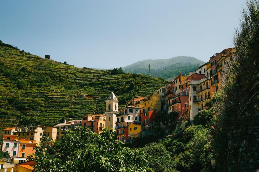
The Church of Madonna di Montenero
Distance: 5km • Difficulty: Moderate • Map
Looking to escape the crowds? The Church of Madonna di Montenero is a lesser known but beautiful hike. The trail leads to a hilltop sanctuary overlooking the Gulf of La Spezia, while the route is rated as moderate but not too difficult for those with a basic level of fitness.
Beginning near Riomaggiore, the hike starts with a steep(ish) climb. The reward? Some seriously awe-inspiring views of the countryside.
Along the route, you’ll pass through dense forests and discover ancient ruins and historical landmarks dotted throughout the countryside. The sanctuary itself is a peaceful and serene place, with a small church, a statue of the Virgin Mary and a panoramic terrace offering views of the sea and the mountains.
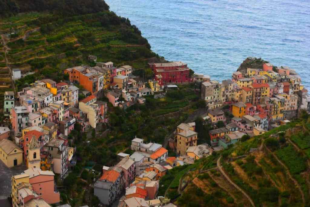
Manarola to Corniglia Trail
Distance: 5.8km • Difficulty: Moderate • Map
Want to hike between Manarola and Corniglia? This is one of our favourite sections of the Blue Path. This picturesque but challenging trail will take around 3-4 hours to complete.
Be warned: this trail is steep and rocky, with many steps and narrow paths, so it requires a good level of fitness and agility. The breathtaking views of the sea along the way are totally worth it though, we promise.
Practical Tips for the Best Cinque Terre Hikes
What is the best hike in Cinque Terre?
The best Cinque Terre hike? This will depend on how much time you have and whether you’re an experienced hiker or not. Personally, we love The Blue Path that connects each of the five villages but for those of you after something a little bit more laidback, the Path of Love is ideal.
What to bring for a Cinque Terre hike
You don’t need to bring or wear anything special for a Cinque Terre hike. Just make sure you’re in comfortable clothing and sensible shoes – hiking trainers or boots are best. And you have plenty of water and snacks tucked away.
Make sure your phone is fully charged before you head out on a hike, and bring a portable battery pack on longer hikes.
